Disclaimer: This post contains affiliate links.
We have a living approach to geography. It’s not a separate subject but one that we occasionally integrate into our normal curriculum by studying maps as the opportunity arises. Basically all we need is an atlas and some outline maps. But I had a big gap in my resources when it came to historical maps.
No longer.
WonderMaps Review
I have added WonderMaps software to my geography resources. I love it! Back in China, I had a CD of maps that I used every now and then, but WonderMaps blows that totally out of the water because the maps, besides being so plentiful, are very customizable. Watch my quick video to see what I’m talking about.
As I said on the video, the historical maps are designed to go along with Bright Ideas Press’s The Mystery of History curriculum. But history is history, so the maps work whether you are using Beautiful Feet, Heritage History, or something else.
Besides the historical maps, WonderMaps includes world maps and maps of the states of America. So basically, it’s an all-in-one resource that you can use for any mapping need for every child for every year you homeschool.
WonderMaps is perfect for
- map drills
- geography notebooking
- history studies.
When I asked Tyler Hogan at Bright Ideas Press about making the screencast above (he gave me permission, of course), he told me that registered users get free updates when new maps are issued. WonderMaps can be purchased as a digital download or as a physical CD.
Besides the maps, WonderMaps has a couple of MP3 talks and some print articles about teaching geography.
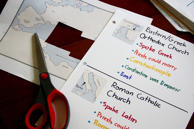
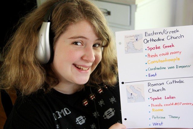
Using WonderMaps for Ancient Rome
In the photo above and below you can see how the WonderMap of ancient Rome was just what Sprite needed for her comparison of the Greek Orthodox and Roman Catholic churches. Yes, she cut up a WonderMap. I hope the people at Bright Ideas Press won’t mind! But all Sprite needed was a thumbnail view of Constantinople and of Rome to complement her lists of features.
Looks like a great resource I’ll have to check out. We are doing “enough” geography this year, but I do want to make it a little more relevant to what we’re studying next year, so I’m working on planning ahead! I always find your reviews super-helpful, so thanks!
Oh, this looks really nice and useful in so many ways! It’s great to have maps easily accessible and not have to go hunting for what you’re needing. Glad you shared!
Geography is an area where I have struggled a bit. I just purposed yesterday to do more with geography–so important as our culture becomes more diverse and global, I think. Thanks for reviewing this resource…I’ll add it to my list of possibilities!
We love WonderMaps too. It’s so nice to always have the exact map you need at your finger tips.
What a wonderful resource! We are doing a Intellego unit study this summer to introduce Geography, but I have been looking for something to use for more specific lessons, actual map work, etc. Thanks for the review.
I love how you did the screen capture to show us exactly how to use this product. This is the most versatile homeschooling geography product I’ve seen!